

LeFrelon Pisteur
Track, converge, help locate nests, in the field.
A free app for beekeepers, associations and volunteers who use the bait station technique and flight timing to work back to the probable location of a nest.


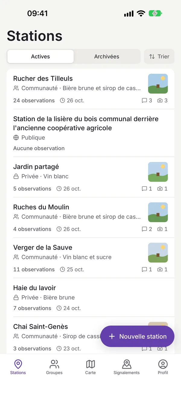
Manage your bait stations
Create and follow your bait stations with their bait, photos and field notes, archive the ones you no longer use and find the history of each station.
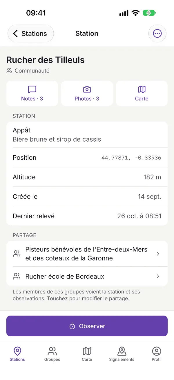
Detailed records
View each station in detail: photos, GPS position, altitude, latest reading and the groups it is shared with. Everything is synchronised with your private space on lefrelon.com.
Measure flights
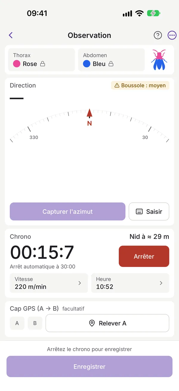
Note the hornet’s marking colours, time its round trip and record its departure direction with your phone’s compass (bearing). The nest distance is estimated as soon as the timer stops.
Several hornets at once
On a tablet, run up to three timers at the same time: each departure locks its colours and bearing, and the radar compass shows hornets in flight at their estimated distance, next to the station’s past observations.
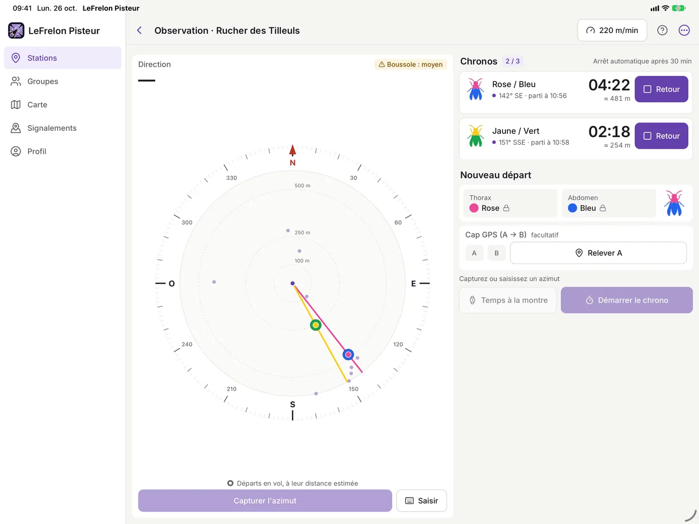
A summary for each hornet
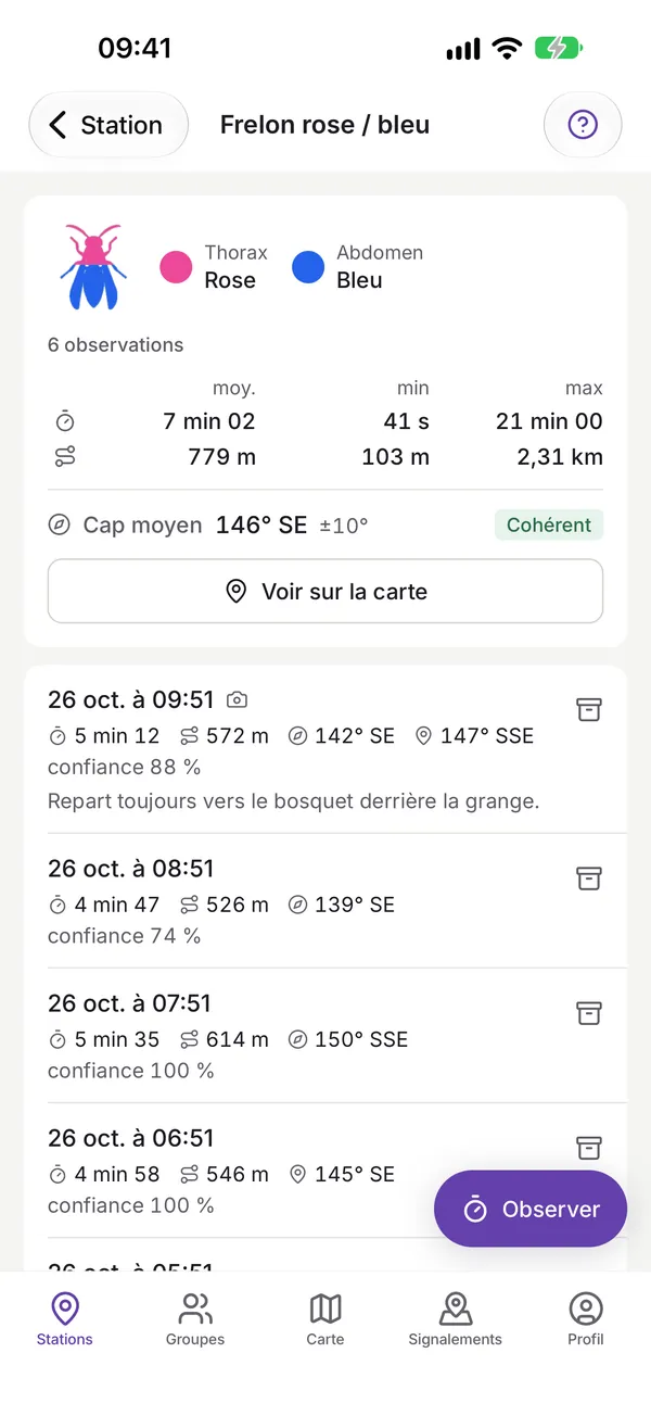
For each marked hornet, find all its observations, the average time of its flights, the estimated distance and its average bearing, with a consistency score for the readings.
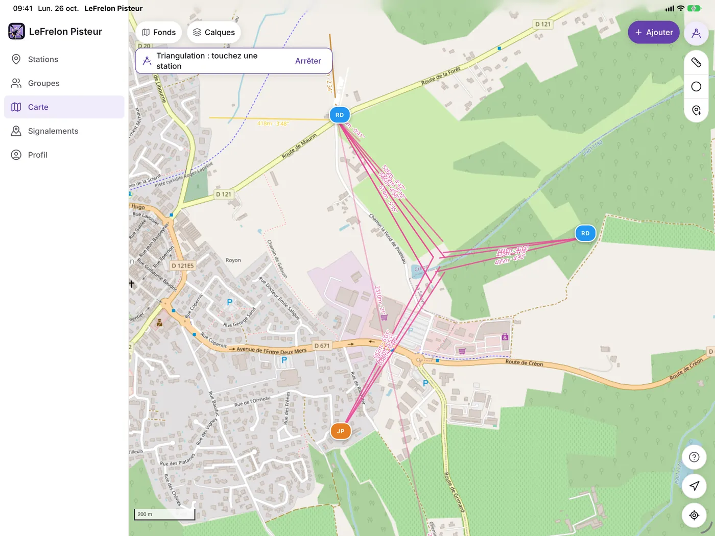
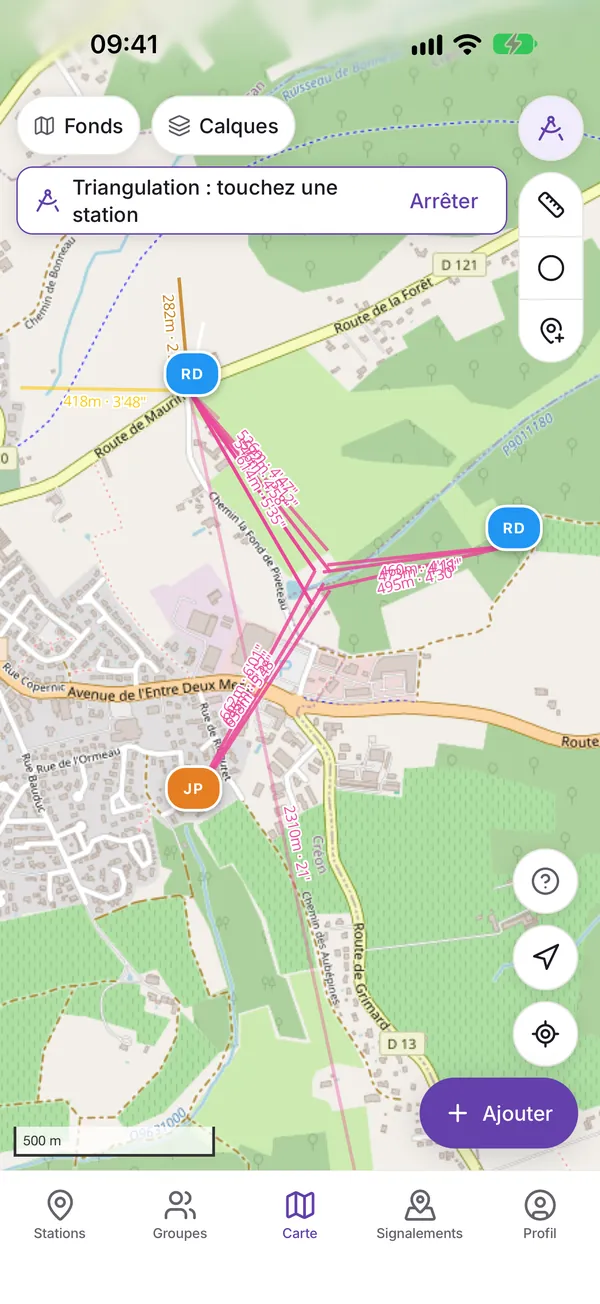
Triangulate the nest area
See your stations and observations on the map with several base layers. Cross the bearings taken from several stations to reveal the probable nest area, measure distances, draw areas.
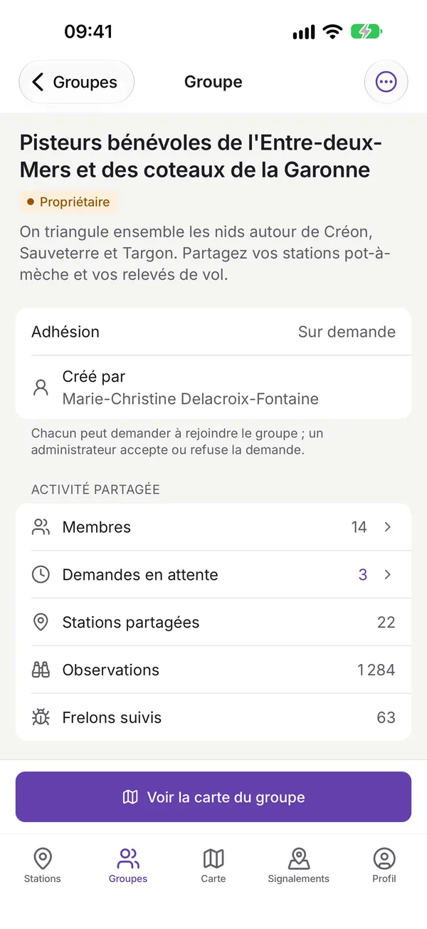
Track together
You choose what you share. Join or create a group of trackers in your area to pool stations and observations, and see the group’s map.
Permissions requested
Precise location
Recording stations (GPS) and readings, and calculating probable areas.
Camera
Taking photos of observations and stations.
Local storage
Keeping a copy on the device for offline access in the field.
Compass and sensors
Measuring the hornets’ departure bearing.
Account required
A free lefrelon.com account is needed to use the app. You cannot register in the app: create your account on lefrelon.com then sign in from the app. Your data is synchronised with your private space.
Safety
LeFrelon Pisteur is a tool to help locate nests. Do not put yourself at unnecessary risk, follow local regulations and call in qualified people when needed.
Ready to track?
Download LeFrelon Pisteur and join the collective fight.